
Hydrographic Surveys Company
Accurate Depth Surveys for Water Projects
Get a Free Quote From Us Today!
We aim to get back to you in 24 hours.
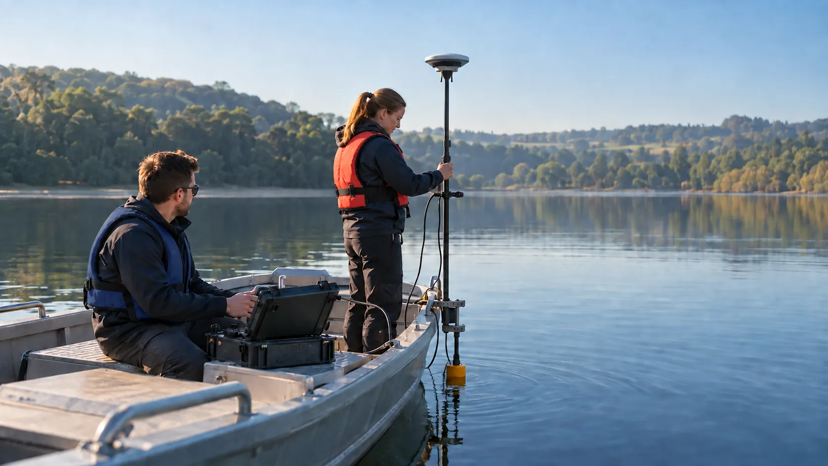
At Hydrographic Surveys Company, we specialise in providing expert hydrographic surveying services for a variety of water bodies, including rivers, lakes, reservoirs and coastal areas. Our services gather accurate depth, position and underwater data essential for engineering, construction and environmental management projects.
We support an array of sectors requiring precise aquatic insights.
Who Is Hydrographic Surveys Company?
At Hydrographic Surveys Company, we are experts in hydrographic surveying, offering detailed analysis and data to aid engineering, construction and environmental projects. We employ multi-beam echo sounders and side-scan sonar to gather accurate bathymetric data, which is essential for understanding underwater terrain.
By using Differential Global Positioning System (DGPS) technology, we ensure pinpoint positioning accuracy, crucial for projects such as dredging and seabed mapping.
Our surveys are integral to the planning and execution of bridge construction, harbour expansions, and coastal erosion assessments. We adhere to established international standards such as those set by the International Hydrographic Organization (IHO), guaranteeing the reliability and accuracy of our findings.
Our expertise extends to conducting habitat mapping and assessing sediment transport dynamics, providing essential insights for sustainable environmental management.
We invite you to contact us to discuss how our survey solutions can support your next development project.
What Hydrographic Surveying Services Does the company Hydrographic Surveys Company Provide?
We provide a range of hydrographic surveying services designed to meet the diverse needs of our clients, focusing on precision and reliability in aquatic environments.
- Bathymetric Surveys: We use multi-beam and single-beam echo sounders to offer accurate measurement of water body depths, crucial for construction and engineering projects involving bridges, ports, and reservoirs. This service supports compliance with local marine regulations.
- Seabed Mapping: Detailed mapping of underwater topography is essential for dredging operations and habitat assessment. We employ advanced sonar systems to ensure comprehensive coverage and data accuracy, beneficial for environmental impact studies and marine spatial planning.
- Side Scan Sonar Imaging: Our high-resolution imagery helps in identifying underwater features and potential hazards, such as shipwrecks or debris, supporting maritime navigation safety and archaeological research.
- Sub-bottom Profiling: Through the analysis of sediment layers beneath the water’s surface, we assist geological studies by using seismic reflection techniques. This service is particularly useful for assessing sediment drift and sedimentary basins.
Contact us today to discuss your project needs and see how we can assist in your hydrographic surveying requirements.
When Is Hydrographic Surveying Needed?
Hydrographic surveying is crucial when preparing for engineering and construction works in or near aquatic environments. It is typically required for dredging operations, environmental impact assessments, infrastructure development near water bodies, and navigational safety assessments.
We commonly assist in the design of ports and harbours by providing accurate bathymetric data, which is essential for calculating sediment volumes and predicting the areas that may require regular dredging.
Our surveys also play a significant role in assessing flood risk for urban planning, where understanding river flow patterns and water levels is essential for designing flood defences. Both private developments and public sector agencies rely on our surveys for safe and effective project planning.
Additionally, our work supports renewable energy projects by helping to determine the suitability of sites for offshore wind farms and tidal energy installations.
Get a Free No Obligation Quotation Today
How Does Hydrographic Surveys Company Work?
Our work follows a systematic and precise process to ensure accuracy and reliability in every survey.
- Initial Consultation: We start by discussing your specific survey requirements, assessing the geographical scope and environmental conditions. This helps us determine the necessary resources and timeline for the project.
- Data Collection: Using advanced sonar technologies like multibeam and sidescan sonar, and precise GPS systems, we gather accurate bathymetric and topographic data. This step may involve deploying remotely operated vehicles (ROVs) or unmanned surface vessels (USVs) to access areas difficult for manned vessels.
- Data Analysis: Our team diverges into careful analysis and processing using specialised software like CARIS or QPS to produce navigationally correct charts and 3D models. These tools enable us to highlight critical aspects such as sediment types, underwater obstructions, and habitat mapping.
- Report Delivery: We provide comprehensive findings tailored to project needs, adhering to industry standards such as IHO S-44. Our reports include data visualisation, charts, and actionable insights, ensuring stakeholders can make informed decisions.
We invite you to contact us for more information or to schedule a consultation.
Who Does Hydrographic Surveys Company Help?
We assist a wide range of clients requiring aquatic data, including engineering firms, environmental consultants, construction companies and government bodies. Our surveys benefit clients involved in mapping underwater terrains and ensuring offshore structures’ safety.
For engineering firms, we provide critical data for designing bridges, tunnels, and pipelines by using multibeam echo sounders to capture detailed seabed topography.
Environmental consultants rely on us for sediment analysis and water quality assessments, using equipment like sub-bottom profilers to measure sediment layers. Construction companies benefit from our precise position-fixing services, enabling accurate placement of materials for projects such as seawalls and jetties.
Government bodies often engage us for compliance checks and maintaining navigational channels, particularly where siltation and erosion are concerns.
Our services are invaluable for any projects related to waterway infrastructure, environmental monitoring and coastal development. Contact us to see how we can support your specific hydrographic needs.
How Quickly Can Hydrographic Surveys Company Respond?
We understand the importance of timely data collection in projects such as coastal development and marine resource management. Our team usually responds to survey requests within two to three days, depending on project scope and location.
We employ precise equipment, such as multibeam echosounders and side-scan sonar, to ensure we are ready to collect accurate data as soon as possible. Our scheduling is flexible to accommodate emergency assessments and urgent needs, especially for clients in industries like offshore construction and environmental monitoring.
For personalised timelines and availability, contact us directly to discuss your project requirements. We strive to align our services with your deadlines and objectives, ensuring minimal disruption and effective project planning.
How Does Hydrographic Surveys Company Ensure Quality and Compliance?
At Hydrographic Surveys Company, we adhere to rigorous industry standards to ensure the precision and reliability of our data. Our survey practices are aligned with guidelines set by the International Hydrographic Organization (IHO), which is critical for guaranteeing the accuracy required in projects such as marine infrastructure and coastal erosion assessments.
We use modern survey equipment, including multi-beam echo sounders and side-scan sonar, both of which are certified for precision. Regular equipment calibrations are conducted using traceable reference instruments to ensure consistent performance.
Our team follows a stringent internal quality management system that complies with ISO 9001 standards, ensuring all operations meet recognised benchmarks.
Additionally, we invest in continuous staff training and development, ensuring that our hydrographers are knowledgeable about the latest methods, such as real-time kinematic (RTK) positioning for enhanced location accuracy. This commitment helps us maintain superior service delivery and meet diverse client needs in sectors ranging from port authorities to environmental agencies.
Request a free quote
Why Choose Hydrographic Surveys Company?
Our commitment to quality and technical expertise sets us apart in the hydrographic surveying field. With a focus on delivering precise and reliable data, we provide several compelling reasons why clients consistently choose us:
- Expert Team: Our skilled surveyors bring over a decade of experience to each project, possessing certifications in hydrography and cartography from accredited institutions.
- Advanced Technology: We employ multi-beam echo sounders and side-scan sonar for precise data collection, ensuring detailed and accurate underwater mapping.
- Custom Solutions: Our services are tailored to meet specific project needs, whether for coastal engineering, environmental monitoring, or port management, adapting to each client’s unique requirements.
- Reliable Data: We adhere to International Hydrographic Organization (IHO) standards, providing consistently accurate and timely information that clients can trust for decision-making and project planning.
Our adaptability and solid expertise make us the preferred choice for comprehensive hydrographic surveying services. Contact us to discuss how we can assist with your project.
Frequently Asked Questions
What Is Hydrographic Surveying?
Hydrographic surveying involves collecting data about the physical features of water bodies. It includes measuring depth, mapping underwater topography, and identifying potential hazards.
How Much Does a Hydrographic Survey Cost?
The cost of a hydrographic survey can vary depending on the size and complexity of the project. Contact us for a personalised quote based on your specifications.
How Is Data Collected During a Survey?
We use sonar techniques and GPS systems to gather accurate depth and position data during our hydrographic surveys.
What Industries Benefit from Hydrographic Surveys?
Hydrographic surveys are beneficial for industries involved in engineering, construction, environmental monitoring, and government agencies managing waterways.
How Often Should Surveys Be Conducted?
Regular hydrographic surveys should be conducted, especially before major construction projects or after significant environmental changes.
Get a Free Quote
Contact us today to find out how our hydrographic surveying services can support your next project.
speak with our team today
What People are Saying About Us
★★★★★
“The Hydrographic Surveys Company team were careful around our waterside site, and their results let us plan the works properly. I would recommend them to others.”
Sophie Jennings
London
★★★★★
“Delighted with the water survey from Hydrographic Surveys Company. Organised, friendly and very professional throughout.”
Charlotte Duncan
London
★★★★★
“Hydrographic Surveys Company were so much better than I had hoped, a helpful and friendly bunch from start to finish.”
Harvey Nolan
London
★★★★★
“Hydrographic Surveys Company arranged our river survey far sooner than I expected. Their chart showed depths in clear colour bands, so our engineers could read it at a glance.”
Thomas Nolan
London
Our Locations
We are proud to work nationally across the UK, allowing us to ensure we can provide services to you.
For a full list of counties we cover in the UK, see below.